The Amauulu Project
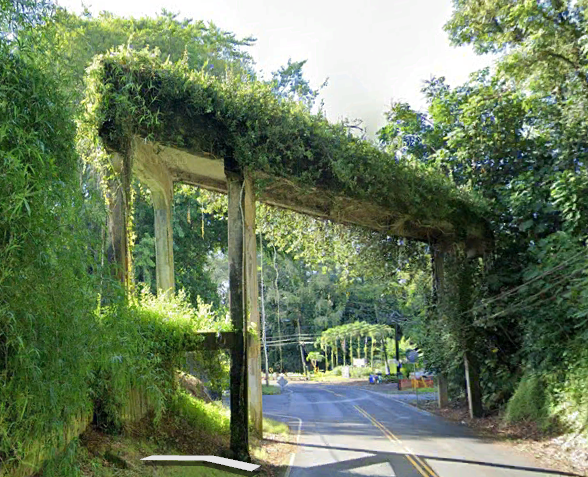
Amauulu is the name of the main road that goes through the majority of the Puueo ahupua'a. The correct Hawaiian spelling is ‘Ama’uulu. ʻamaʻu - All species of an endemic genus of ferns, Sadleria +ulu (no ʻokina!) means growing Thus, the growing ʻamaʻu fern(s) is the meaning. Most of the ferns are gone since sugarcane was planted in the middle section, and Waiwi has taken over the forest at the top. My thanks to Ellen Hocker for this information. Maybe one of our goals should be to make the name accurate again.
What do you do with land that has been ignored for decades?
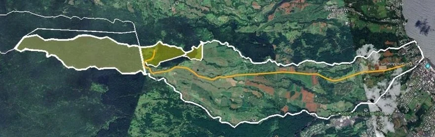
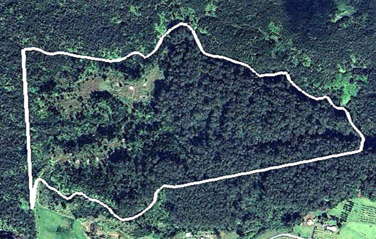
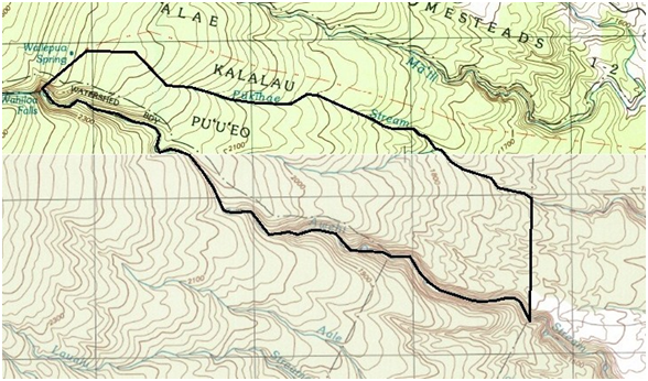
Lavaloha owns three properties that are currently not used. What these properties should be used for depends on your vision of the future, but maybe we can make something that will work well for decades, no matter what the outside world does. The three shaded lots are the focus of the project. Each lot is unique in it’s history and potential use.
First comes descriptions of the lots, starting with the rightmost lot.
Possible paths forwared comes next.
Lot 3-2-6-28-4
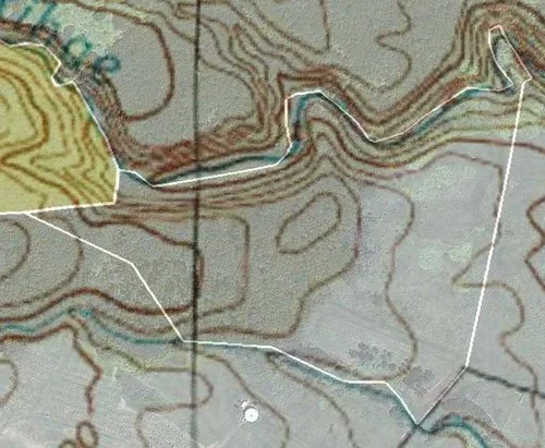
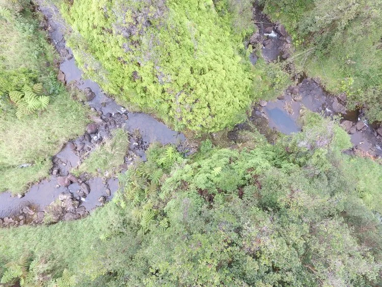
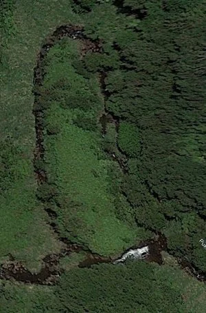
The peninsula/island
The three pictures above show how the Pukihai can switch from taking the loop to taking the short cut. Look at the leftmost picture closely, and it looks like there is a concrete dam section. The upper left photo is from Google Earth in 2015. The right one in 2018 after a major rain storm. The leftmost picture was taken using a drone.
The distance from the concrete to the land on peninsula/island is about ten vertical feet. The stream drops about 20 feet going around the loop.
There is even a stone dam that goes across the river. A pipe comes out of the dam, but only goes a few inches. This pipe may have provided water for one of the sugar cane campsl
Lot 3-2-6-28-1
This lot is 118 acres and is reportedly planted in Eucalyptus Robusta. Robusta currently does not have enough commercial value to make it worth cutting. These trees were planted in the 1930’s and could become valuable in a few decades.

1954 photo. Well defined rows
2013 photo. Saligna is grown up
What to do?
One thing that we could do is subdivide it. we could make four parcels, each with access to a road. The picture shows a possible division. Note that each lot has a relatively clear are to put a house, and all but the one bordering lot 3-2-6-18-8 has trees that could be harvested in the future.
These lots all have their agricultural use built in. The one exception is the one that borders the conservation lot, an we might want to keep that one anyway.


1964 photo with additional plantings
2024 photo. Saligna harvested

Lot 3-2-6-18-8
Overview
The lot begins at around the 1600 foot elevation and extends to 2400, and is about two miles long from the lowest to the highest elevation. The acreage is variously described as 341 acres to 490 acres. It has not been surveyed in at least a century.
This lot covers roughly the same altitude range as the upper end of Kaiwiki Road, about a mile away, and, unlike the upper part of Kaiwiki, is Conservation lland.
Forest Description
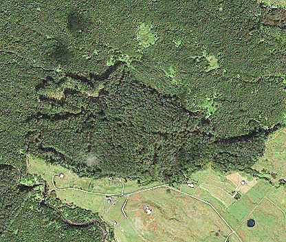
The forest is accessible off of the top of Amauulu road over a short easement on TMK 3-2-6-28-8, or directly from TMK 3-2-6-28-1, owned by Mahilani Partners. We have ventured into the forest up to a half mile in a few locations, and have found the forest to be almost exclusively waiwi (psidium cattleianum or strawberry guava), with some Melastoma Candidum, and patches of Palm grass. There are a some hapuu, and a few dead, or nearly dead Koa trees. The fallen Koa are often used as nurse logs for the ubiquitous waiwi.


This picture shows the wall of waiwi that marks the transition between grass and Koa on the adjacent 20 acre agriculture lot (left), and Mahilani forest (right). The waiwi in the forest has diameters as great as six inches and shades the ground so thoroughly that there is no understory other than waiwi and other invasives.
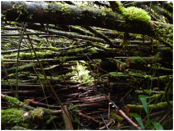
Although there are occasional small clearings, the majority of the land is covered by dense waiwi. In some places large clumps of waiwi have fallen over making it challenging to get through even with the assistance of a chain saw.
The small clearing at the upper right contains young waiwi and melastoma, and tree moss covered ohia.
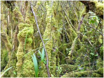
In much of the forest the waiwi is so dense that the RH remains near 100% and moss grows on everything.
So far we have found about half a dozen koa trees, two are barely alive, and the others are dead or even fallen over with waiwi growing out of them. We have found one very large ohia, which is so tall that that it has been able to survive the waiwi . Koa can also grow very tall, but they are very poor at recovering from damage. When the lower branches are shaded out, they die and with time the waiwi crowd the Koa enough to kill rhem.
.Waiwi was originally imported from Brazil as an ornamental, but thrives in wet environments, such as this forest. The clumps it makes are so dense it crowds out almost all native vegetation. The key to recovery of this forest is to suppress the waiwi. There is a solution: tectococcus ovatus (scale insect), which has been shown to be effective in reducing the fruiting of waiwi, but it is not yet approved for use. The barrier appears to be political rather than scientific. Of the over 1000 yards of foot trails we have walked we have seen no Koa saplings at all. The waiwi have completely choked out the understory of the forest.
We are unsure of the condition of the forest beyond the first half mile. The forest lot is two miles long, and there are indications that some Koa has survived at the higher altitudes. A Google Earth image from August 2013 shows defoliated Koa trees (Koa moth): roughly 4 per acre at 2400' elevation, 3 per acre at 2200', 1.5 per acre at 2000', and none below 1800'. In the short excursions we have made, we have found no indications of Sandalwood. If there had been some, it was likely logged out almost two centuries ago.
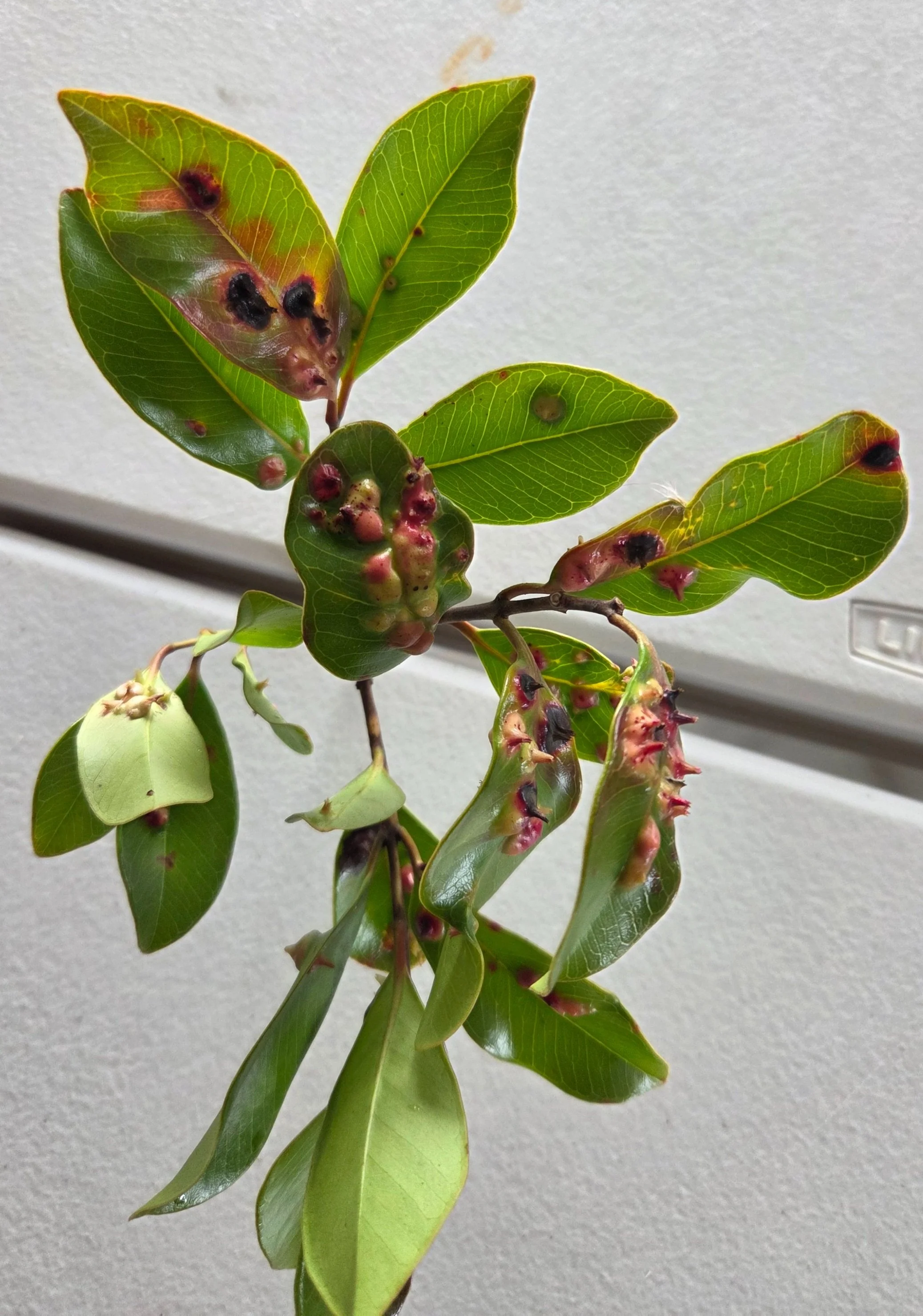
The introduction of tectococcus ovatus has damaged the Waiwi, making it less effective in fruiting and propogating. Included is a picture of a damaged Waiwi twig.
Site History:
This site is part of the Amauulu Plantation that appears to be part of the lands that Benjamin Pitman acquired when he married Chiefess Kino’ole o Liliha. In about 1851 he sold the property to Thomas Spencer. In 1867 the plantation had 375 acres in sugar cane. A map from 1880 shows a flume on this lot, drawing water from the Awehi Stream that forms the southern boundary of the lot. This flume was used to carry sugar cane from the lots below until probably the 1940’s when trucking replaced carrying cane in flumes.
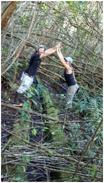
Chris has found this flume, and after cutting a path through the waiwi along its length concluded that it has not been used in a very long time. There are at least 3 sections of the flume that are broken, and some sections are covered by landslides. The picture at the left shows an aerial view of the dam and entrance to the flume on the Awehi Stream. Below right we see Chris and his wife Julianna providing scale to the concrete flume. At this particular location, the waiwi density is relatively low so making a path consisted mostly of cutting though the fallen waiwi.
Directly below you can see GPS positions Chris made while tracing the flume. Near the flume start it was cut into the side of a hill making walking near the flume dangerous.
This property was sold to a forest management company in Oregon in 2002, and purchased, and deeded to MP in the fall of 2012.
There are at least two other flumes on the lot besides the one shown above. One is hand-dug, and is thoroughly overgrown. We have not traced it to its source, though it seems to follow the path described on the next page. Another is nicely formed concrete, but only about 125 feet long. We can see both ends, but have no idea what its purpose was.


This map is from 1924 and shows a flume starting near the top of what is now 3-2-6-18-8 all the way to the processing plant near the sea. The concrete flume crossing highway 19 and Wainaku likely part of it.
So what can we do with it?
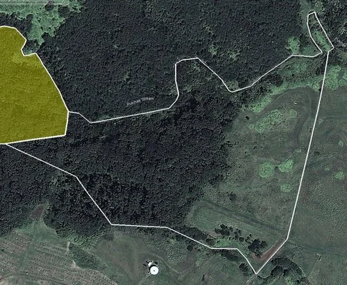
Path on map from 1917
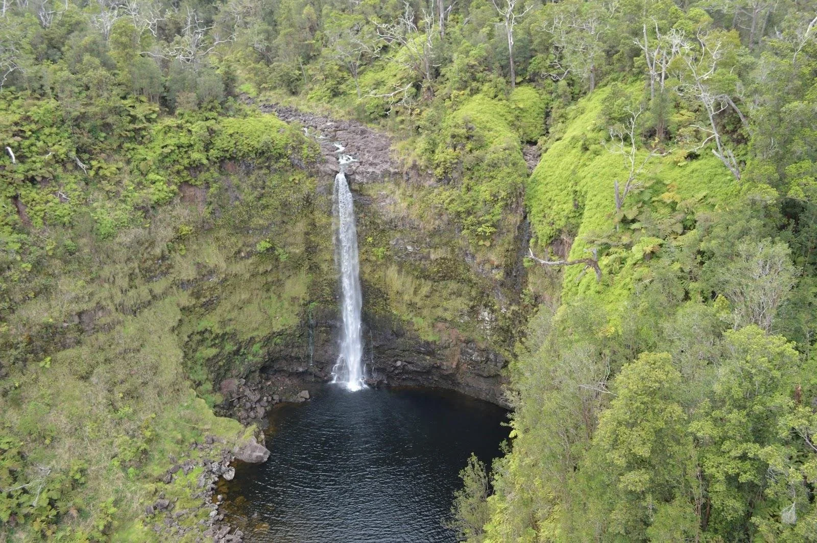
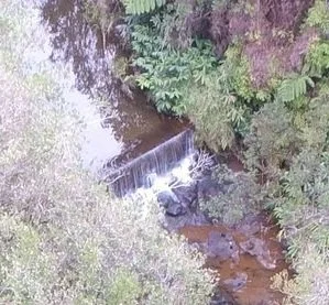
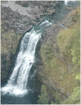
The Hilo USGS map from 1917 shows a path into the forest that goes past the flume area. The corresponding Honomu USGS map doesn’t show the path. This path is not shown on any subsequent USGS maps. We have made a trail that follows this trail until the abrupt turn southwest. There is a ditch on the left side of the trail/path until that point. Following from there would require a great deal of effort because of a wall of moss covered waiwi. We think that path might have provided access to the remarkable Wahiloa Falls at the top of the property (shown below the map).
KOA
The koa on the property is dying because it is being crowded out by the Waiwi. Eradicating the Waiwi would make it possible to harvest the dying Koa and allow the Koa to start again. Koa seeds last many decades, and will sprout when given the opportunity.
Tours
The historic flumes and many waterfalls could make this an interesting tourist destination. The start of the path is only about a mile above the Lavaloha base where chocolate tours begin
Restoration
Bringing this property to its condition one to two hundred years ago, would be a challenge, but one that could follow both of the efforts above. Obliterating the Waiwi will be an daunting task, but doable with the right resources.
Step one
The property is relatively narrow, but about two miles long. To do any reasonable assessment of the property would require making a path that runs from the low end to the waterfall at the top. Following the path next to the flume makes sense. It will necessarily have a reasonably constant slope, and also provide a view of the flume(s). The only casualties would be the Waiwai trees that are causing the problem. Making the path wide enough for an ATV would allow handicapped or older folks to have access.
1981 Environmental Impact statement
https://files.hawaii.gov/dbedt/erp/EA_EIS_Archive/1981-08-HA-EIS-Eucalyptus-Biomass-Farm-Development-at-Puuueo.pdfs://files.hawaii.gov/dbedt/erp/EA_EIS_Archive/1981-08-HA-EIS-Eucalyptus-Biomass-Farm-Development-at-Puuueo.pdf